Exploring Crime Data in Austin
Author
B. Robert Owens
Civic Committee of the Commercial Club of Chicago
John K. Roman
NORC at the University of Chicago
May 2026
Crime reduction strategy benefits from hyperlocal knowledge. Few places illustrate that point more clearly than Austin on Chicago’s West Side.
Austin has long struggled with elevated rates of violent crime and has been a site of significant focus and investment by the Civic Committee’s Public Safety Task Force. However, the community contains multitudes.
Austin is the third largest of Chicago’s Community Areas by both population and area. The gang affiliations that drive violence in Austin are complex and fractured, and crime and violence are unevenly distributed within the community. Austin is also the site of remarkable community assets and a rich network of civically engaged organizations devoted to serving and strengthening the community.
Figure 1 displays heat maps of the last 10 years of homicides for the West Side community of Austin. Tract-level patterns within Austin show violence patterns that diverge significantly from the Community Area average. In the last 10 years, violence has concentrated in central Austin, and along the east side boundary it shares with Garfield Park. Austin’s western boundary with suburban Oak Park and its northern boundary with Belmont Cragin have usually been quieter.
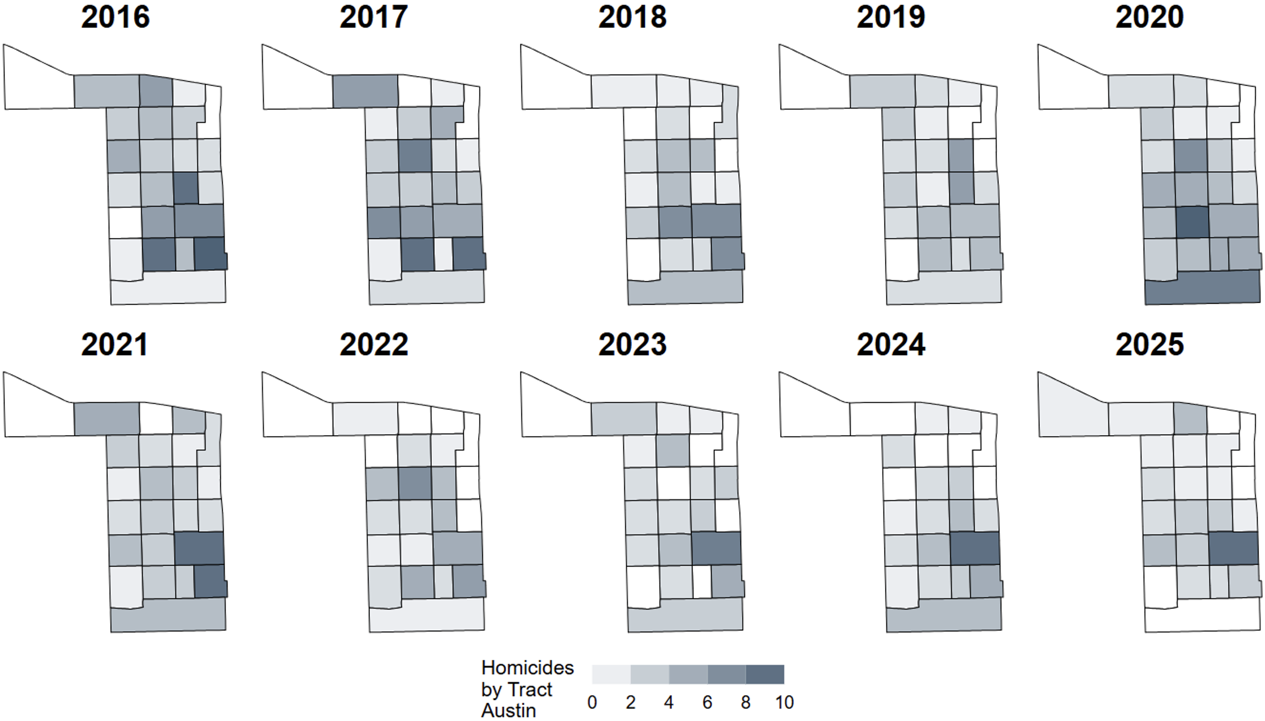
Figure 1. Homicides at the census tract level in Austin, 2016–2025
When we overlay violent crime data with other metrics, we sometimes find correlations between violent crime and other measures of concentrated disadvantage in the same areas.
For example, city- and county-owned vacant buildings in Austin are concentrated in the southeastern quadrant of Austin, where homicides are most frequent (Figure 2). These are the kinds of patterns that researchers and public safety policymakers must continuously revisit and evaluate in the holistic pursuit of safe neighborhoods. Since 2003, Chicago has had a public-private partnership in place, the Troubled Buildings Initiative, to mount a programmatic response to troubled and potentially dangerous properties. The program is run through a collaborative effort of the City and the nonprofit Community Investment Corporation (CIC). City agencies coordinate to identify and remediate troubled and potentially dangerous properties, if necessary moving them into receivership.
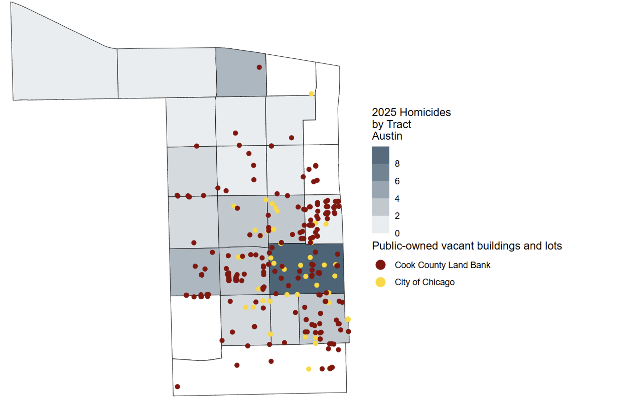
Figure 2. Vacant properties and homicides at the tract level in Austin
The Civic Committee and NORC will soon launch a powerful new tool on the DataHub for tracking violence at the block level, along with many other public safety and city service metrics. Analyses like those shown above for Austin will be available for Community Areas, blocks, and block groups across the city, with historical and current data continuously updated.